Tour Overview
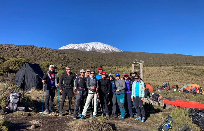
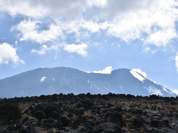
Shira Route is a little used trail that begins near Shira Ridge. It is nearly identical to the Lemosho route. In fact, Shira was the original route and Lemosho is the improved variation. Although Shira is a varied and beautiful route, it is less favorable than its successor due to the relatively high altitude of Shira's starting point, which is accessed quickly by vehicle. It is possible that climbers will experience some altitude related symptoms on the first day while camping at 11,800 feet. The route approaches Mount Kilimanjaro from the west, beginning with a long drive from Moshi to Shira Ridge. The vehicle bypasses the rain forest zone and the hiking trail begins on Shira Ridge. The Shira route crosses the entire Shira Plateau from west to east in a pleasant, relatively flat hike. Then the route traverses underneath Kilimanjaro's Southern Ice Field on a path known as the Southern Circuit before summiting from Barafu. Descent is made via the Mweka route as others route.
ITINERARY
Day 1: Mooram starting point to Shira 1 Camp
Elevation: 11,800 ft to 11,800 ft
Distance: 4 km/2 miles
Hiking Time: 1-2 hours
Meals: Breakfast, Lunch & Dinner Included
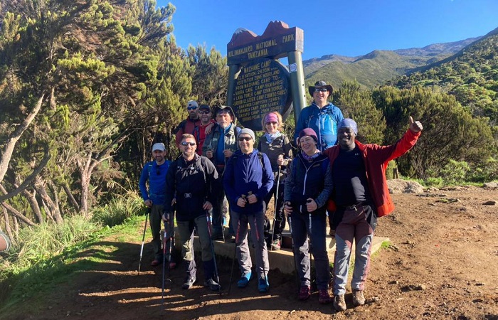
We depart Moshi for Londorossi Gate, which takes about 4 hours; here we will complete entry formalities while guides and porters prepare equipment. We then continue to drive up a steep path to the Moram which is starting point where we will begin the hike.
The trek starts through shrubs and giant heather until we reach shira 1 Camp.
Day 2: Shira 1 Camp to Shira 2 Camp
Elevation: 11,800 ft to 12,500 ft
Distance: 6 km/4 miles
Hiking Time: 2 hours
Meals: Breakfast, Lunch & Dinner Included
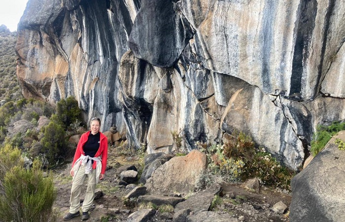
Today is a fairly easy day to help with acclimatization. We begin by exploring the grassy moorland and volcanic rock formations on the plateau. Then we take a scenic path to the Shira Cathedral, a huge buttress of rock surrounded by steep spires and pinnacles,
before settling at Shira 2 Camp.
Day 3: Shira 2 Camp to Lava Tower
Elevation: 12,500 ft to 15,190 ft
Distance: 7 km/4 miles
Hiking Time: 4-5 hours
Lava Tower to Barranco Camp
Elevation: 15,190 ft to 13,044 ft
Distance: 3 km/2 miles
Hiking Time: 2-3 hours
We continue to the east up a ridge and then head southeast towards the Lava Tower - a 300 ft tall volcanic rock formation. We descend down to Barranco Camp through the strange but beautiful Senecio Forest to an altitude of 13,000 ft. Although you begin and end the day at the same elevation,
the time spent at higher altitude is very beneficial for acclimatization.
Day 4: Barranco Camp to Karanga Camp
Elevation: 13,044 ft to 13,106 ft
Distance: 5 km/3 miles
Hiking Time: 4-5 hours
Meals: Breakfast, Lunch & Dinner Included
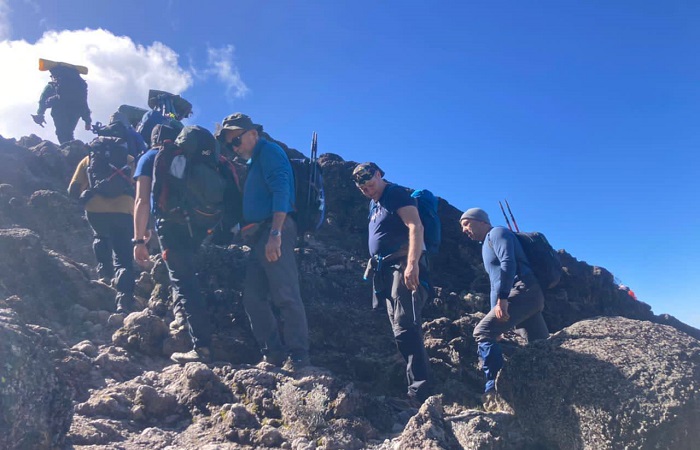
We begin the day by descending into a ravine to the base of the Great Barranco Wall. Then we climb the non-technical but steep, nearly 900 ft cliff. From the top of the Barranco Wall we cross a series of hills and valleys until we descend sharply into Karanga Valley. One more steep climb up leads us to Karanga Camp.
This is a shorter day meant for acclimatization.
Day 5: Karanga Camp to Barafu Camp
Elevation: 13,106 ft to 15,331 ft
Distance: 4 km/2 miles
Hiking Time: 4-5 hours
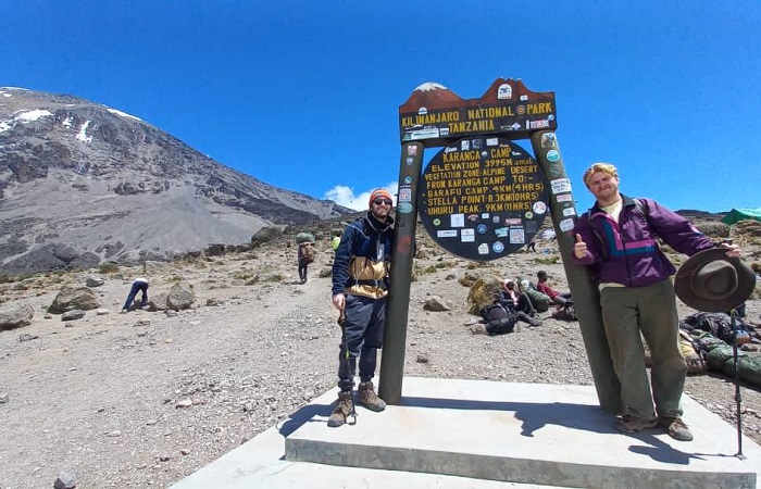
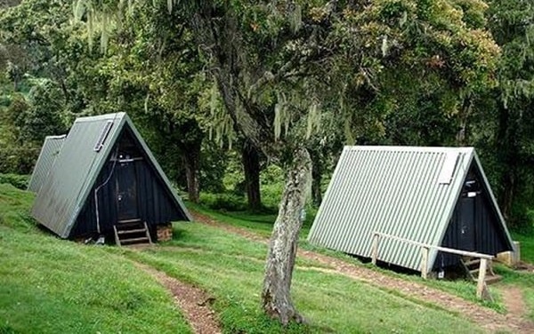
We leave Karanga and hit the junction which connects with the Mweka Trail. We continue up to the rocky section to Barafu Hut. At this point, you have completed the Southern Circuit, which offers views of the summit from many different angles. Here we make camp, rest and enjoy an early dinner to prepare for the summit day. The two peaks of Mawenzi and Kibo are viewable from this position.
Day 6: Barafu Camp to Uhuru Peak
Elevation: 15,331 ft to 19,341 ft
Distance: 5 km/3 miles
Hiking Time: 7-8 hours
Uhuru Peak to Mweka Camp
Elevation: 19,341 ft to 10,065 ft
Distance: 12 km/7 miles
Hiking Time: 4-6 hours
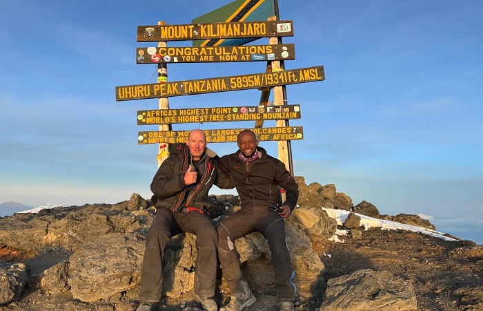
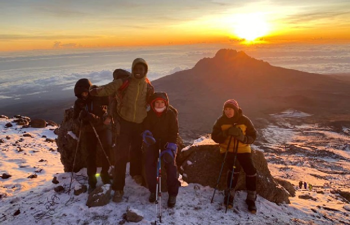
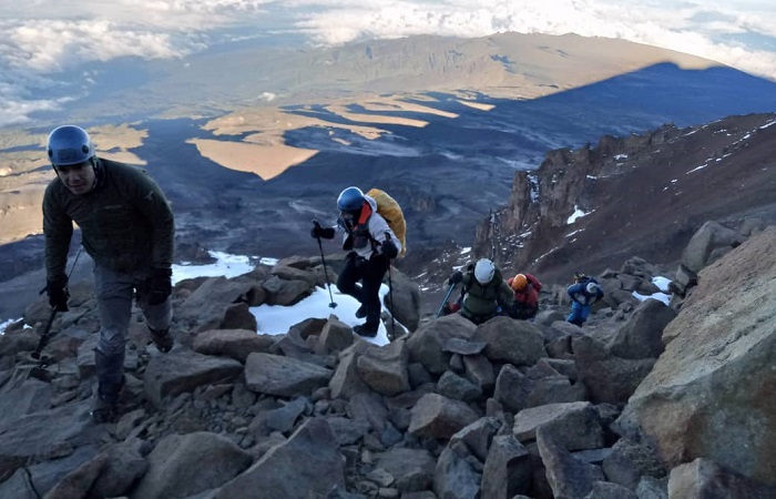
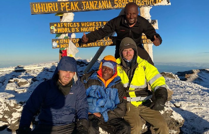
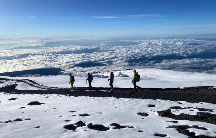
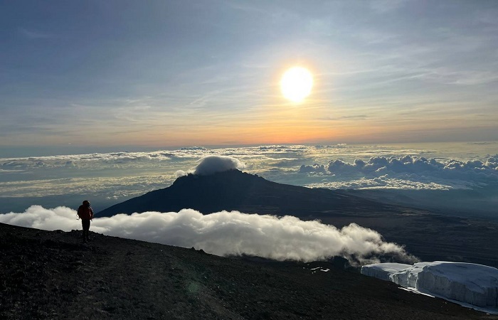
Very early in the morning (around midnight), we begin our push to the summit. This is the most mentally and physically challenging portion of the trek. The wind and cold at this elevation and time of day can be extreme. We ascend in the darkness for several hours while taking frequent, but short, breaks. Near Stella Point (18,900 ft), you will be rewarded with the most magnificent sunrise you are ever likely to see coming over Mawenzi Peak. Finally, we arrive at Uhuru Peak - the highest point on Mount Kilimanjaro and the continent of Africa.
From the summit, we now make our descent continuing straight down to the Mweka Hut camp site, stopping at Barafu for lunch. The trail is very rocky and can be quite hard on the knees; trekking poles are helpful. Mweka Camp is situated in the upper forest and mist or rain can be expected in the late afternoon. Later in the evening, we enjoy our last dinner on the mountain and a well-earned sleep.
Day 7: Mweka Camp to Mweka gate
Elevation: 3100m to 1830m, 10,200ft to 6000ft
Distance: 10 km
Hiking Time: 3-4 hours
Vegetation: Forest
After breakfast, we continue the descent down to the Mweka Park Gate to receive your summit certificates. At lower elevations, it can be wet and muddy. Gaiters and trekking poles will help. Shorts and t-shirts will probably be plenty to wear (keep rain gear and warmer clothing handy).
A vehicle will meet you at Mweka gate to drive you back to hotel in Moshi
SHIRA ROUTE FAQ
What is the success rate of the Shira route?Whilst there are no official statistics, the average success rate across all Kilimanjaro operators for the 7 days Shira route is around 85%
What is the altitude of the Shira Plateau?
For those who want to experience the thrill of climbing Mount Kilimanjaro without wishing to summit, book a hike on the spectacular Shira Plateau. This plateau stretches out over 13 kilometres to the west of Kibo, at an elevation of 3 962 metres.
What is the difference between Lemosho and Shira route?
The Shira route is one of the older Kilimanjaro routes, and is very similar to the Lemosho route. The only differences between them is the trail walked on first couple of days, and that the starting point of the Shira is higher.
How high is Shira Camp Kilimanjaro?
Shira Camp 2 (3,847m) sits on the Eastern edge of the Shira Plateau. It is the first camp at which altitude sickness might start to be felt. It also provides stunning views across the Kilimanjaro valley below.
How long is Shira?
The Shira Plateau is a 13km stretch of land on the western side of Mount Kilimanjaro. It sits at about 3,800 meters and is one of the highest plateaus in the world.
How many days do you need on the Shira route?
The Shira route can be completed in either six days or seven days. The extra day gives you more time to acclimatise. In our experience, most people who have completed the right Kilimanjaro preparation and are okay with the higher altitude at the start of the climb, manage fine with the seven-day option.
Price Per Person
- GROUP SIZE (US-Dollar)
- 1 Person $ 2240
- 2-4 People $ 2120
- 5-7 People $ 2040
- 8-10 People $ 1960
- 10 ++People $ 1900
- Private transport to & from Kilimanjaro International Airport to your accommodations in Moshi.
- 2 nights of accommodation in Moshi.
- Transportation to & from the Kilimanjaro gate
- Park entry fees,
- Camping fees.
- 18% VAT on tour fees & services
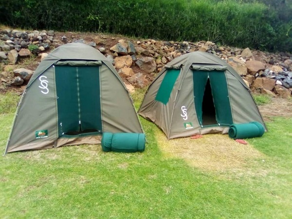
- 4 Season mountain tents
- Double layered Sleeping Mats
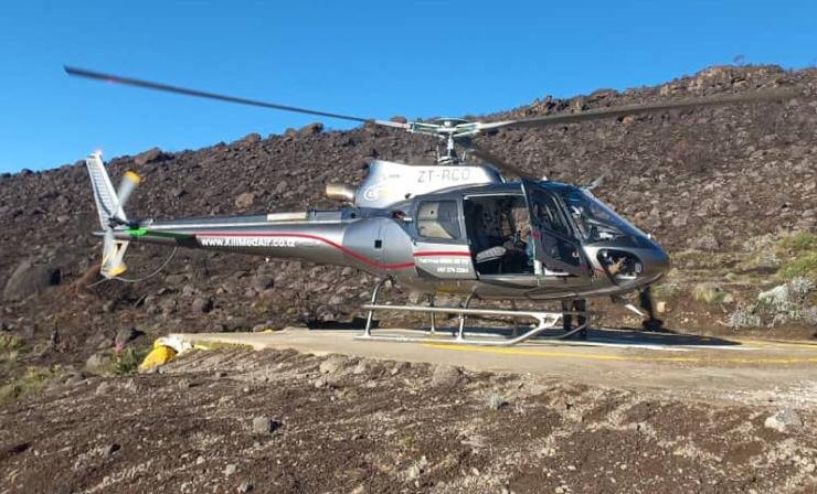
- Team Kilimanjaro Rescue fees.
- Friendly and professional mountain guides, cook and porters.
- 3 hot meals daily while on the mountain.
- Fair wages for the mountain crew as approved by the Kilimanjaro National Park Authority (KINAPA), Kilimanjaro Association of Tour Operators (KIATO)
- Portable oxygen tanks & ox meter
- Enough treated & filtered drinking water throughout the trek.
- Hot water for washing.
- Government taxes
- Emergency first-aid kit.
- Lunches, dinners and drinks at your hotel before and after climb.
- Travel insurance.
- Flights.
- Laundry (Available at hotel).
- Personal items and toiletries.
- Tips for guides, porters and cook (this is a guide to tipping on the mountain.


